Friday, October 11, 2013

Sangre de Cristo Trip: Crestone Peak

I was sitting in our hotel room in my long underwear texting my friend, feeling defeated. We had been turned back from the Crestones by a bad hailstorm and we were discouraged enough that there was mention of leaving the range all together. Our plan for the rest of the peaks was to backpack into the basin and then climb the nearby peaks. But we were turned off from backpacking since all our gear was soaked and we had to waste a day drying it out. The thought of leaving the range all-together to cherry pick some easy peaks elsewhere just sounded depressing. We came to the Sangres to climb the Sangres. It's an amazing range and it would be a shame to leave after only 2 summits. So we decided to drive around the range and make an attempt on Kit Carson, Challenger, and Crestone Peak.

At the Willow Lakes trail head (TH for Kit Carson/Challenger), we parked our jeep and spread out all our gear in the sun to give it a chance to dry out. It wasn't long before most of it was completely dry and we just had the day to relax at the campsite. We sat out a one hour long storm in the afternoon inside the Jeep. Throughout the day, hikers came down the trail to head home and I made a point of talking to as many of them as I could. Kit Carson and Challenger are right next to the Crestones, so the area experienced the same storm that we did the evening before. One man got stuck above treeline in a cave at 11,800 while his wife waited for him in their tent below, but they spoke of it like it was nothing. The next lady tried to cross the creek and almost fell in but was caught by a man on the other side. One couple made it across one of the two stream crossings, but had to stay the night, hoping the next stream crossing went down enough to be safe. Two old men told us about how incredibly scary the stream crossing was since it was white water directly above a cliff. They met a couple climbers who were climbing the Prow, a class 5 route up Kit Carson, and were stuck on the wall, exposed to the elements for the 30 minute hail storm. Finally, a couple forest rangers returned and showed us pictures of the stream crossing. All the rocks and logs that they had personally placed there were completely washed out and the creek was raging. Seeing the pictures, there was no way I would even consider trying to cross that stream, so we decided that we wouldn't attempt Kit Carson/Challenger for at least another day. We decided to attempt Crestone Peak via Cottonwood Creek the next morning.

None of us knew very much about this route up the peak. We had a short description about the approach in our Roach guide book, but none of us had studied the route like we had all the other routes in our plan. So I took a horrible photo of our map and we woke up at 1:30 for a 2:00 start time.

A completely useless iPhone photo of our map

The approach was tough. With our early start, we would be walking in the dark for a good 3.5 hours, which made the poorly maintained trail very difficult to follow. We lost it several times throughout the morning, but always found it again, since we at least knew that the trail followed Cottonwood Creek for the majority of the time. Eventually, the trail veers left and climbs up towards the basin area below the needle and peak. There were a couple sections where we had to climb up some steep, featureless slabs, knowing that it wasn't going to be very fun to descend. The sun started to rise as we approached treeline, but even in the sunlight, we had trouble finding our route. Standing in a talus field, we looked all around us and saw cairns in all directions. To continue in the direction we were already going looked like a dead end at a large waterfall and cliff. So we followed a cairn that cut to the left up a steep hill. We continued passed the cairn and climbed up a steep, grassy gully. The cairns disappeared and we figured that we must have gone the wrong direction. We could see very far, so we just chose our own route to the base of Crestone Peak's red gully through boulder fields and grassy slopes. 


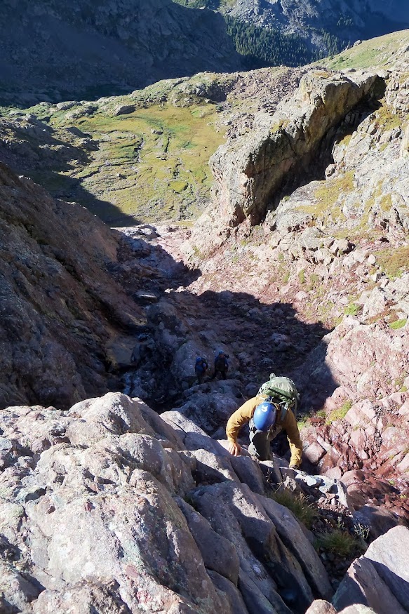
About 5 hours into our hike we were finally at the base of the actual climb. The red gully seemed to go on forever above us. From here it would be a 2,000 ft class 3 climb up to a saddle about 100 ft from the summit. The view was daunting to say the least.

The red gully

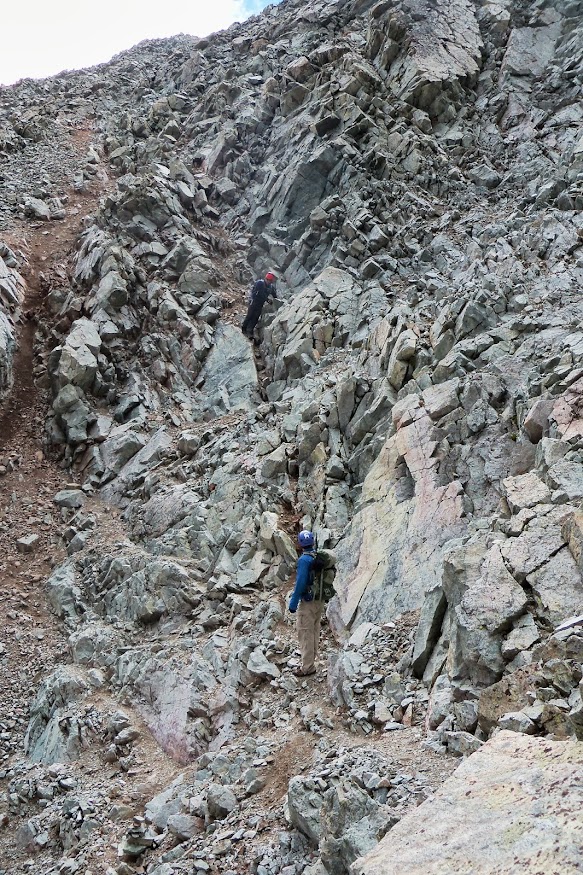
So on came our helmets and we packed our trekking poles for the climb. The gully was relentless. We were gaining elevation fast because it was so steep, but it was very tiring. It was really just a long slog up a gully with the same view the entire time. There was water flowing down the gully most of the way up so there was a lot of wet rock to avoid. A few times, Tony and I chose some more difficult lines to avoid the slippery rocks in the middle of the gully.


But the climb went on and on and I was ready to be at the top. Richard ran out of water about 2/3 of the way up so we stopped at the stream flowing down the gully and filtered some water for him.


Towards the end of the gully we could see all the way to the sand dunes and the Blanca group.


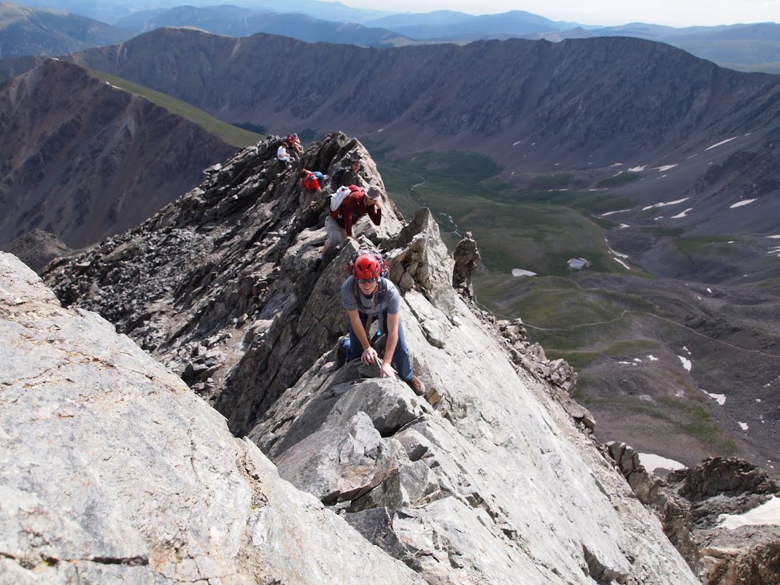
Finally we made it to the top and enjoyed some time on the most spectacular summit I had ever been on. It was a shame I was so tired and that clouds were starting to form. Otherwise I would have enjoyed sitting on the summit more. 


Remember how we were hoping to climb Kit Carson and Challenger? Well, we took a look to the north to see how much hail hadn't melted yet and sure enough the Kit Carson Avenue (the long diagonal white line near the top) was piled full of hail. The Avenue is a wide ledge that must be followed from the Challenger summit on the left in order to keep the climb up Kit Carson class 3. Combining the danger of the hail-filled ledge and our fatigue from this difficult hike we were on, we decided to not try to climb the peaks the next day.


The climb down from the peak was long and frustrating. The gully was quite loose and we kept on triggering small rock slides. One small rock hit my head, which thankfully had a helmet on it. The clouds seemed like they got thicker and thicker. About halfway down we met a man who was climbing up. He had left his pack at the base of the gully and was carrying nothing. Not even a water bottle or a rain jacket. Crazy man. 


Right when we reached the bottom of the gully it started sprinkling. And then it started raining. And then we heard thunder right when we were reaching some trees. On the descent, we actually found the correct route that we should have taken up and it really wasn't any better than the route we chose. There was a ton of bushwacking through wet bushes and at one point, we had to shimmy down a steep and slippery class 4 chimney next to the waterfall. I didn't blame us for thinking the waterfall was a dead end on the way up. It was a sketchy down climb. With all the bushwacking, Richard eventually blew up. I could hear him struggling to get through a bush and then he just screamed out in anger. The rest of the hike out, he barely said a word except to complain about this horribly maintained trail that we had to hike. He was having a rough day and apologized to us later that evening.

The hike out was mostly uneventful and the trail was much easier to follow than it was in the dark that morning. It was raining for about an hour, so the steep slabs that we had to climb up were terrifying to go down. If we lost our footing, we would slide about 100 feet down the slab and while it wouldn't be fatal, it would be very painful and bloody.

It took forever, but we finally made it to the bottom and all three of us wanted nothing but a burger and beer. So we drove out of town to this place that we saw had a big sign saying, "Burgers and Beer Here." Sadly the place was closed so we drove back to the town of Crestone to find another restaurant. A man at the grocery store pointed us towards the only restaurant in town where we went and enjoyed some pizza, burgers, and beers. It was a nice way to unwind and observe the interesting Crestonian hippies that congregated at the restaurant. Exhausted, we all slept well that night. 

This was definitely the most difficult hike of our trip. It was something like 13 miles with 6,000 ft of elevation gain. Definitely long enough to have done as an overnight trip, but it felt like a big accomplishment to do it in one big push. The fast and light alpine style, I guess. I would like to come back to the Crestones someday, camp at South Colony Lakes and then attempt the traverse between the peak and the needle. And maybe someday in the not too distant future I'll get to climb the 5.7 Ellingwood Arete up the needle. These are some truly spectacular mountains.

Friday, September 27, 2013

Sangre de Cristo Trip: Humboldt Peak

I was really excited to spend a night or two out at South Colony Lakes. From the pictures I had seen, it looked like an amazing place with a beautiful view of one of the most picturesque peaks in Colorado - Crestone Needle. It was going to be nice to just spend some time away from the roads and just relax in the wilderness.

We left early this morning, around 4AM. It was going to be a long walk up to the lakes and we would be carrying our big backpacks with all our camping gear. Little did I know, my partners were planning on taking everything but the kitchen sink for this short, 2 night backpacking trip. Their packs weighed over 50 lbs, and I was carrying less than 25lbs, still falling into the "heavyweight" category according to ultralight hikers. The hike up south colony road was painfully slow. Eventually, we got to the old trailhead where a small trail cuts north to the lakes and the sun was starting to rise. We hiked through the woods as the trees started to thin and finally got our first good view of Crestone Needle.


Soon we arrived at the lower south colony lake and looked around for a campsite. Being Labor Day, many of the camping spots were full, but we were able to find a good one sheltered by short pine trees, close to the creek where we could collect water. We didn't eat a proper breakfast that morning so we set up our tents and spent some time cooking oatmeal. Enough lollygagging around, we decided to head on up Humboldt before any storms came in.


The classic Ellingwood Arete on Crestone Needle

The climb up Humboldt was much harder than I expected, mostly because I've started a bad habit of not paying attention to route descriptions for "easy" hikes. The hike starts out with a bunch of switchbacks up to the saddle below Humboldt. I was expecting this to be the only hard part and the rest to be really easy. But it was actually the other way around. From the saddle to the top, it was a bunch of tiring boulder hopping up a steep slope.


Slowly but surely we made progress. I could tell that Richard was starting to acclimatize. He still said that he felt very tired, but he was climbing noticeably faster than yesterday. The hike itself wasn't anything to write home about, but the views certainly were with the Crestones in full view.


We made it to the summit and as usual, we only spent about 15 minutes there and made our way down to avoid storms. We saw a young couple taking two corgi dogs up the mountain and it looked like a horrible idea with all the boulder hopping. It wasn't long until we looked back and saw that they gave up because of the dogs' slow pace and headed back down. We made it back to our campsite and began our day of lounging around.


While we were lounging at camp an older man told us that his water filter was clogged asked if he could borrow ours. So I went down to the creek with him to help him fill up. I got down to the creek and realized that I forgot the bladder for my filter, so I left the filter with the man and jogged back to camp to get the bladder. At this point, it was starting to rain and by the time I got back to camp, it started to pour. I had no interest in going out in the rain to get my filter back, figuring the man would return it. So I just hunkered under a pine tree to wait out the storm. Tony found a tree nearby to stand under and Richard went into his tent. We figured the storm wouldn't last too long, but it wasn't stopping. The older man, soaking wet, came up to our camp to return my filter. I had some dirty water in my bladder, so we sat under the trees and chatted for a few minutes while the water filtered into his Nalgenes. He thanked us and ran over to his site just 100 feet from ours.

The storm didn't get any better. It started hailing and the lightning was getting closer. We were staying relatively dry under the trees, but the hail was able to get through the branches and there was really no place we could stand without getting pelted. We started to notice that a stream was starting to form and it was flowing under our tents. Tony and I tried to dig some quick trenches to get the water to go around the tent, but the hail just got worse and we gave up, just praying that the tent stayed waterproof and didn't let our down bags get soaked. We felt horrible for choosing such bad places for the tents. My dad had always taught me to not set up a tent where water would flow, but over the years I had grown lax and just chose the nice flat spot.

The storm had been going for 30 minutes at this point, with 15 minutes of rain and 15 minutes of hail, and I was starting to shiver. I was wearing a rain jacket with a t-shirt and hiking pants. There were no signs that it was going to stop anytime soon, so I opened up my pack to get my puffy jacket, hat, and gloves and I put them on under my rain jacket. This helped a lot, but I was still cold. The hail was piling up and Tony and I decided we would try to get into the tent to stay warm. When we opened to tent and Tony jumped in, it was floating on 2 inches of water and it just didn't seem like it would be very helpful for us to sit in there. So we continued waiting under the trees. The hail finally stopped after coming down for 30 minutes. The rain continued coming down, but seemed to be relenting a bit. At this point all 3 of us were cold and most of our gear was wet. The hail had piled up to about 3 inches. If we stayed there for the night, we would be cold and wet and none of us really felt like having a miserable night, so we decided to head back to the Jeep, which would take 3 hours. We packed up all our heavy soaked gear and headed out. It was a long, tiring walk, but we made it just as it was getting dark. We threw in the towel for the day and decided to stay in a hotel where we enjoyed a nice shower.

I was really disappointed and upset with myself for not choosing a better camping spot. It we had chosen a higher spot to put our tents, we probably could have comfortably stayed the night and had a chance to attempt the Crestones the next day. That night at the hotel we were talking about what we wanted to do for the rest of the week. It seemed that our plans for the week were toast. We were a bit turned off from backpacking and unfortunately the other hikes we had planned would include at least one night of backpacking. We almost decided to leave the Sangres and do some day hikes in the other ranges, but that would have been really disappointing to have driven all the way down there only to hike 2 14ers. So we decided to just spend a day drying out and drive to the other side of the range and then attempt to do two really long day hikes up Kit Carson/Challenger and up Crestone peak from the west side.

The two lakes in the hail piles where our tents were

Thursday, September 26, 2013

Sangre de Cristo Trip 2013: Mt. Lindsey

My checklist was checked and my backpack was packed. I spent the morning drinking a hot cup of coffee and listening to music. Before I knew it, two men were walking down my stairs and greeted me. I wondered, who are these two white guys coming down my stairs and how do they know me? It took a few seconds, but I realized that they were Tony and Richard, my two climbing partners for a week in the Sangre de Cristo mountains. It was time to go, so we hopped in Richard's rental Jeep Grand Cherokee and started our drive south. I had met Tony the week before on a hike to Mt. of the Holy Cross, but I had only gotten to know Richard via Facebook stalking. So the conversation had its gaps, but we all had enough to talk about and were comfortable enough with each other.

After a long highway and a long rough dirt road, we made it to our campsite for the night at the Mt. Lindsey trailhead. We camped at the trailhead and had a beautiful view of the Iron Nipple.


The plan was to get a 5:00 start the next morning, so we gathered water from the creek, ate our dinner, and headed to bed early. These alpine starts suit me pretty well because I'm usually so excited for an upcoming climb that I can't sleep anyway. I can't say I'm too crazy about walking in the dark though.

Walking in the dark the next morning proved to be challenging. The trail to Mt. Lindsey had social trails that diverged then converged and it was very easy for us to get lost while navigating in the dark. As we approached treeline the sun rose and we got to see the beautiful views once again.


We walked through this beautiful valley above the trees with a great view of Blanca Peak and climbed to a saddle that connects Mt. Lindsey to Iron Nipple. From here we could finally see our route. There are two options. The first is to climb a loose scree gulley up the face that supposedly stays class 2 and the other option is a class 3 climb up the ridge on solid rock with a short easy class 4 section near the top. I was eager to try out a class 4 route for the first time, so I had already convinced my partners to do the ridge. I would say that it was the safer option. There was some exposure, but much less chance of a rock fall compared to the north face.

Mt. Lindsey's northwest ridge and north face from the saddle

At the saddle we all put our helmets on and packed our trekking poles. The ridge looked foreboding and Tony would later tell me that the scariest part of the route for him was standing here at the saddle, looking at the route. It wasn't long before it was evident that we were going to need to do a good bit of route finding to stay on route. I took the lead and kept us high on the ridge for the majority of the climb. It was a lot of really fun class 3 scrambling with a bit of exposure and, of course, really good views.


We were getting close to the crux of the route and I stayed close to the ridge crest. I saw 2 climbers ahead of us who had descended to the base of a narrow gulley that leads to the crux. I thought they had stayed too low and got themselves into a difficult climb. But it was only a minute later when I cliffed out and could not stay on the ridge any longer. So we backtracked 100 ft and traversed the ridge lower down across a pretty sketchy exposed section to get the the base of the crux gulley. The crux was a lot of fun. It took some careful climbing and time to find holds, but we all made it up. The crux was actually easier than I expected, but I must have given my climbing partners the wrong impression about the climb. Richard was pretty shaken by the exposure and told me that he didn't plan on climbing any more class 4. Tony, however was a bit surprised by the difficulty of the climb but later told me that it was one of the most fun routes he had ever climbed. It was the same for me. Right up there with Kelso Ridge.


We were nearly at the top and it was just a tiring hike to the summit. We only spent about 15 minutes at the top because clouds were starting to form. Again, we had the option of the two routes to descend, but we opted for the north face gulley to avoid the very steep sections on the ridge. The gulley was less loose than I expected. We were able to stay to the side, which had somewhat solid rock. Still, we saw several people heading up the gulley without any helmets and deemed them to be crazy for not using helmets on the loose rock.


The walk back to camp was pretty nice. I'm always pretty tired after climbing a 14er, but relative to some of the very long days I had earlier this summer, I felt great. The hike was 8 miles and 3500ft of elevation gain. We went really slow because this was Richard's first day at high altitude after flying in from South Carolina. Probably not the best idea to get him killed on his first day. The slow pace made for a good warm up hike for me and left me excited for the rest of the climbs.

That night we drove up the road a ways to South Colony Lakes trailhead and set up our tents for the night. We had another early start in the morning, so we didn't sit around the campfire for too long.


Monday, September 23, 2013

Summer of Hiking

All last winter I was itching to do some hiking and I resolved that this summer would be the summer of hiking. Originally my goals were to start climbing class 3 and to do Long's Peak, Kelso Ridge, and The Sawtooth by the end of the summer. Class 3 climbing means that you need to use your hands to climb, but it is easy enough that you can go down the slope with your body facing outward. The only 14er routes I had done previously were class 2, which is just difficult walking, so class 3 seemed a bit intimidating to me.

I started out the summer with a climb up Kelso Ridge with my coworker and his friends. It was the funnest 14er route I had ever climbed. There were 3 or 4 sections that required careful climbing and a few spots with a ton of exposure. The exposure was exhilarating and the climbing was fun. I immediately knew that I wanted to do more climbing like this. This kind of climbing is so much more engaging for me. You actually have to use your brain to carefully make hand and foot placements and to keep yourself from freaking out with a hundred foot drop on either side.


The infamous Kelso Ridge knife-edge

Fun exposure on Kelso Ridge

Summer was speeding by before I knew it and I hadn't come up with any vacation plans. This couldn't stand. Last summer involved lots of knitting, reading, and bike riding around Denver. I wasn't going to let that happen again, so I started thinking about a trip to the Sangre de Cristo Mountains in southern Colorado. These mountains are absolutely beautiful and have lots of  challenging routes, the kinds of class 3 routes I was now hooked on. I would have been okay doing this trip alone, but I knew I'd have people bugging me about how dangerous solo hiking is, so I took a look on 14ers.com to see if I could find some climbing partners. Sure enough, a guy from South Carolina posted on the website looking to do a similar trip to what I had planned. A few emails later I was committed to climbing with him and another Coloradan guy for a trip to the Sangres at the beginning of September. 

The trip looked daunting. We planned on climbing 8 14ers in 5 days of climbing, which meant lots of miles and lots of vertical feet to gain. I wasn't in shape for this, so I immediately started training. Cycling was cut down to a minimum with only 1 ride a week and instead I started running and hiking more, with a goal of climbing a 14er almost every weekend.

Over all my time training I summited 11 14ers, hiked a total of 92 miles and 41,000 ft of elevation gain. By far the most hiking I've ever done in a summer! It was good for me to have a goal to train for. I am not someone who is very good about exercising for the sake of exercising. The running was tolerable and all the hikes were a lot of fun. My two favorites were a traverse of the Gray's-Torreys valley (Steven's Gulch) and a Bierstadt-Sawtooth-Evans combo.

The Steven's Gulch traverse made for a long day. It was 9.2 miles with 6,000 ft of elevation gain, so I started early at 4:15 and was hiking for over 9 hours. The majority of the hike was just a walk, but I had the pleasure of climbing Kelso Ridge again, which was plenty of fun. Towards the end of the day I was absolutely exhausted and found myself stopping frequently to rest. I had summited 5 peaks that day already, and near the end of the traverse I was able to see this view.

Steven's Gulch

Just being able to look at the entire route from the day gave me a great sense of satisfaction even though my body was completely beat. I plotted out the route in Google Earth afterward and I couldn't help but be giddy at how aesthetically pleasing the route was. I had never done a big valley traverse like this before, but I thought it was wonderful because you get to spend a ton of time above treeline on fun ridges and return back to your car by the end of the day.

Steven's Gulch Traverse Route

Earlier in the summer I did the Bierstadt-Sawtooth-Evans combo, which also made for a long day, but a great sense of satisfaction afterward. I went up Bierstadt via the standard West Slope route and it was raining the whole time, even with a 5:43 start time. By the time I got to the top, my gloves were quite wet and the summit was sitting inside a cloud. There were two small groups of climbers at the top and we spent 20 minutes talking about the dangerous conditions on the Sawtooth that connects Bierstadt and Evans. The rocks were slippery and the visibility was poor. I was tired of waiting for the others to decide and I was confident that this route was well within my abilities as long as I was careful. So I said goodbye to the two teams of climbers, put on my helmet and headed to the ridge by myself. It was only about 20 minutes before visibility cleared up and the rocks were never all that slippery. The traverse across the Sawtooth was quite fun with only one tricky climbing section. The rest of the hike was just a long slog. It felt like it took forever for me to get to the summit of Evans because I never looked at the route description enough to realize that it is actually quite far to the summit from the Sawtooth. But I eventually got there and spent 15 minutes with everyone that drove up there on the road. On the descent back to Guanella Pass the sun finally came out, just in time for me to walk through the muddy valley back to my car. I was exhausted after 10.25 miles and 3500 ft of hiking, but happy that I decided to make it a long day instead of turning around at the top of Bierstadt.

The Sawtooth Ridge

These were just two of the many hikes I did this summer. I discovered two fun hikes near Denver called Mt. Morrison and Goat Mountain. They're steep climbs with a little bit of class 3 and very little foot traffic. Bear Mountain in Boulder is a really fun and easy way to get tired without driving very far. The Decalibron is a hike that combines 4 14ers and I was glad I did it because it's a really easy way to get 4 summits without walking very far. The Mt. of the Holy Cross was probably the most scenic hike I did while training. We took the Halo Ridge route and it made for lots of boulder hopping and a very long day and we were absolutely exhausted by the end of it. Missouri was a disappointing hike for me because I had high aspirations of combining it with Belford and Oxford, but was thwarted by the weather and my exhaustion, so I only summitted Missouri.  Here are the stats for my training hikes:
Route Date Miles Elevation Gain
Mt. Morrison 6/7/2013 3.6 2000
Goat Mountain 6/8/2013 6.4 1980
Decalibron 7/6/2013 7.25 3700
Kelso Ridge 7/13/2013 6.75 3100
Mt. Morrison 7/21/2013 3.6 2000
Goat Mountain 7/24/2013 6.4 1980
Bierstadt-Sawtooth-Evans 7/27/2013 10.25 3900
Mt. Morrison 7/30/2013 3.6 2000
Bear Mountain 8/4/2013 5.9 2941
Tour de Steven's Gulch 8/10/2013 9.2 6000
Mt of the Holy Cross 8/17/2013 15 5210
Mt. Morrison 8/20/2013 3.6 2000
Missouri 8/24/2013 10.5 4500
Totals 92.05 41311

After all this training, my trip to the Sangres was just around the corner. I felt like I was capable of tackling our hardest day in the Sangre's, but I really didn't know if I could do strenuous hikes every day for a week. I just spent the week resting and hoped I wouldn't be in the worst shape of the 3 of us.


Sunday, August 25, 2013

Feeling Small

I turn on my headlamp and start to walk. All that I have is a map and a small cone of light in front of me to find my way. I can barely see the silhouette of the mountains nearby and it is faint because there is no moon. It is easy enough to get lost in the trees when it is light, but the only light I have today is powered by two AAA batteries.

I walk around a chained gate and follow an old road that was probably once used for a mine. My map is telling me that my route starts at the end of the road, so my first goal is to follow the road to its end. Soon I come to a creek that flows across the road. It's only a few inches deep, so I decide that I can just walk across in my boots. I get halfway across and realize that the road is not on the other side. I look downstream and upstream and I'm not sure what happened to the road. No more than a quarter mile into my hike I've already lost my one landmark. Hopefully I can find the road again if I can get back on dry ground so I start to hike into the trees. The mental picture of my map reminds me that the road does not head straight uphill, but to the right some, so I choose to turn to the right and there the road is, just 50 feet away. This would all be so much easier if I could actually see where I was going.

On the road, I'm not lost anymore. I pass through an opening in the trees and I can hear the trickling of a stream just before my boot splashes into it. Soon I come to the end of the road. The end of the road should lead me to a gully with ridges on both sides and sure enough I can hear the stream again, which tells me that there is a gully for the water to flow down. I can just make out the silhouette of a ridge on the right side of the gully. Everything tells me that this is my ridge, but I'm hesitant to make a big route decision with such limited visibility. But I make my decision and head up the ridge.

This is a very steep, sharp ridge and I'm impressed that these trees can live on such a steep hill. Step by step my legs burn and slowly but surely the trees start to thin. I am finally above the treeline. The sky opens up and I can see the Milky Way again. It is relieving to be away from the trees. A dark forest is one of the scarier places to be walking alone.

This ridge does not relent. It's so steep. I stop frequently to give my legs a break and sometimes I turn off my headlamp to look at the stars. They are so far away. It's so dark my peripheral vision can't distinguish between the ground and the sky. I feel myself falling and put my foot out to catch my fall.

It is quite the feeling to be here, alone, above the treeline, off the trail, and in the dark. I've never felt so small. What little light there is draws my attention to big things. Silhouettes of grand mountains far away and light from giant stars that has been traveling for years just to get to my eyes. In the distance I can see a light from a climber's headlamp on Gray's peak -- Just a tiny speck of light beneath the stars on a vast mountain face.

When I look at your heavens, the work of your fingers, the moon and the stars, which you have set in place, what is man that you are mindful of him, and the son of man that you care for him?

Saturday, February 9, 2013

How Music Has Shaped Me As A Person

If you were to ask me what my biggest passion in life is, I would certainly tell you that it is music. I actually am passionate about a lot of things in life, so music only wins by a little bit. Most of the things I am passionate about have roots that go way back to when I was a child. I have yet to fall in love with any activity in my adulthood that isn't in some way connected to something I did as a child.

Music has been an important part of my life ever since I was a child. I come from a very musical family. My dad was a music minister for most of my life, my mom plays guitar and sings, my two sisters sing beautifully, and my brother plays drums, guitar, saxophone, bass clarinet, and I may be missing a few others.

My first encounter with music was probably in children's choir. From what I'm told, I wasn't a very good singer. This doesn't surprise me because I'm still not that great of a singer. I sang in church choirs all the way through my childhood until I was a senior in high school. I can't say I was ever that crazy about singing. It was okay, but it just never clicked with me.

Next up was piano. My dad worked a half day one day a week and during that time he tried to teach me piano. Again, it just didn't click. I wasn't interested in practicing and if you know piano at all, you know it requires a lot of practice. It's a very difficult instrument to really play well. These piano lessons didn't last long, maybe a year or two? But I learned Chopsticks and Heart and Soul, so that was good enough for now.

At my elementary school, every kid was required to either play an instrument or be in choir in sixth grade. At this point in my life, I really wanted to be cool. And being cool meant not caring about silly things like music. I heard the cool boys talking about what instrument they were going to play and it seemed like the coolest option was trumpet. It only has three buttons, so how hard could it be. The plan was to play the easiest instrument, then drop it once I got to middle school where it was no longer required.

Well, I started to play trumpet and once I started to learn it, I started to enjoy it a bit. It was moderately fun, but compared to football and baseball, it was pretty boring. I did enjoy it well enough to keep playing in middle school. All the while I became more and more interested in music. 8th grade was when I was first introduced to jazz. We learned the blues scale and I discovered improv for the first time. I thought it was really cool that you could stay in a certain scale and pretty much whatever you played, it sounded like blues. Jazz band was really a lot of fun for me. Regular band bored me like nothing else, except for the chance to say hi to my crush Karen. But once 7th period came around, I was legitimately excited to play some jazz.

After finishing middle school, I was still pretty excited to play music, so I joined the high school band. Once again, I was at the bottom of the totem pole, so I was stuck in the freshman band. I wasn't challenged and the music wasn't interesting to me, so I began to seriously consider dropping band. I was one of the best trumpet players in the freshman band, but the music did not interest me at all. I remember telling my close friend Bethany about this on the bus ride home one day. She was upset that I was considering quitting. She told me that I was really talented and that it would be horrible to just throw away my talent by quitting. I took this to heart and decided to keep playing.

In band there was a freshman band, a concert band, a symphonic band, and a jazz band. I had heard the concert band before and they sucked! I had no interest in joining a band that just goofed off and didn't play good music, so I tried out for symphonic winds and made it sophomore year. This year was much better. The music was actually challenging and I was no longer one of the best trumpet players. I had several upper classmen to look up to and to learn from. I wanted to keep improving, so at the end of sophomore year, I tried out for the jazz band. This was the band for the most talented musicians in the school and it just seemed like more fun.

Junior and senior years I played in the symphonic winds and the jazz band. So two bands every day, 5 days a week. I fell in love with jazz these years. It really pushed me to become a better player. The music was very challenging and there were many opportunities for improvising. I finally learned the importance of having confidence while playing. Mr. Boysen just told me to play loud even if I know I'm screwing up all the notes. I started to do this and eventually realized that when you do this, you start to realize that the mistakes you make are no big deal. You just take the mistakes as they come and move on to the next notes confidently.

Senior year was pretty hard for me. I was somewhat depressed. I hated most of my classmates because I thought they were living immorally. I was also sad that I had very few friends. The two of these things put together made for a pretty miserable year. Jazz band started at 6:30 in the morning, so I had to wake up at 5:45 every day to go to this completely optional class. One day on the drive in, my dad told me that he was surprised that I was willing to wake up so early just to play jazz. I told him that band was what held me together. Band was the only thing that motivated me to wake up each morning and go to this school where I was miserable. This was the year where I started seeing the comradery in band. There were four sophomore girls in symphonic winds who must have seen my depression and reached out to me. Kelsey, Lexi, Rachel, and Anah really annoyed me at first. They would always say hi and would try to get me to smile (I have a deeply ingrained hatred for being told to smile). But they began to wear on me and by the end of the year I realized that I was actually going to miss these girls who had been so friendly to me. At our last concert Rachel gave me flowers and a page long note saying how much she appreciated my musicianship and how she looked up to me as a musician. On the last day of school, I had just grabbed my trumpet from my locker and was about to slip out of the building, never to be seen again, when Kelsey caught me and gave me a big hug with a look on her face telling me that she was going to miss me. It was these girls and the rest of the band nerds I spent 2 hours a day with who got me through high school And to this day, music people are still my favorite people.


At some point in high school, I decided to pick up the piano again. It was really really heavy, so I just gave up. Instead, I decided to start playing the piano again. I was able to play really easy songs with two hands and over time I taught myself to play some pretty challenging tunes. Piano was mainly a good stress reliever for me. School was stressful because I was always taking challenging classes and every day I would come home and pound on the piano for an hour before starting my homework. It also got me out of doing chores occasionally because I convinced my mom that I would provide entertainment for the rest of the family while they washed the dishes.

Junior year I taught myself to play guitar using an old Mel Bay book that my mom used as a child. At some other point I also taught myself to play saxophone, using my brother's sax, as well as violin, using some horrible violin that we had sitting in a closet at home. There was just something exciting about learning a new instrument. It was a challenge and in the end gave me a lot of confidence in my musical abilities.

Once I went to college, I started playing a lot more guitar. I didn't have a piano in my apartment freshman year, so guitar naturally took its place since it was small and easy to play. In college, band only took up about 3-5 hours a week and I was used to 10 hours of band a week plus 5 hours of playing instruments at home, and an hour of youth choir every week (about 20 hours of music per week). So trumpet was not satisfying my desire to play music often. So I gradually started playing more and more guitar and got better and better at it as I started to learn challenging fingerpicking tunes from the likes of Trace Bundy and Andy Mckee. I led music worship for my sunday school class at church for a while, I led the music for Intervarsity for a semester, I led for my church small group for a while, and now the majority of the music I play is playing guitar for my church on Sundays.

So that's my musical autobiography. Music has been an important part of my life since I was a kid and through time I've grown in my appreciation for it. Hopefully you can see through my story that music hasn't  just been a hobby for me, but actually has been an important factor in shaping who I am today. It has taught me the importance of practicing and having confidence. It has shown me the comradery that is possibly between people with similar passions. And it has helped instill in  me a passion for learning new things.

Wednesday, January 23, 2013

Bouncing X-rays

One of the most interesting parts of my job is a measurement I do everyday called X-ray diffraction (XRD). It's a powerful tool that I can use to tell me about how the materials I work with crystallize. The batteries that I work with work best if the atoms are all lined up in the right direction so it's important to know how they are lined up. There are several ways to change how the atoms are arranged, so we can tune our materials so that they line up properly so that lithium can pass through them correctly.

XRD is mostly useful for crystals. What makes a material a crystal? A material is a crystal if the atoms/molecules are arranged in a periodic pattern. The dots below make a square pattern, so if they were atoms, they would be a crystal.


Or you could arrange the atoms in a different pattern. They would still be a crystal as long as there is a clear pattern to their arrangement. The following is a hexagonal arrangement.


In a complex crystal structure, there may be multiple ways of measuring the distance between atoms. In the picture below, you could measure distances between atoms along the blue line, along the orange line, along the green line, or along the pink line. You can see that the distances are the same for the blue and pink lines, but the distance for the green line is longer, and the distances for the orange line are even longer.


If you know all these different measurements of atomic spacings, then you have a unique way of describing this particular crystal arrangement. For this square arrangement, the atomic spacings are 1, 2.2, 1.4, and 1 for the blue, orange, green and pink "planes" respectively. If you drew similar planes on the hexagonal arrangement, you would see that the atomic spacings are 1, 1.8, 1.1, and 2. So these numbers are unique ways to describe the crystals. So if you had a crystal and you wanted to know what its crystal structure was, all you'd need to do is figure out all the different atomic spacings, look up that set of spacings in a database, and you'd know what the crystal structure was.

The central thing that XRD tells you is what the distance is between atoms, so it provides the way to determine a crystal structure. So how does XRD measure atomic distances? By diffraction. Diffraction is when a wave bounces off a periodic structure. The wave will bounce off the periodic structure and will reflect in a direction that depends on the spacing of the pattern. In XRD, the wave that is used is an X-ray. An x-ray is just light with a very short wavelength. The x-rays I use have a wavelength of 1.5 Angstroms (1.5 x 10^-10 m). Diffraction only works if the distance between atoms is close to the wavelength of the wave. Conveniently, atoms are usually spaced a few angstroms from one another.

If you shoot an x-ray at a crystal, it looks something like this:

One x-ray bounces of one atom and another x-ray bounces off another atom. You can see that the two x-rays travel different distances. The top one travels a shorter distance (2dSin(θ) shorter than the lower one). The difference in paths cause a phase difference between the two x-rays. When they head towards the crystal, they wiggle up and down at the same time. But after travelling different distances, they may or may not be wiggling up and down simultaneously. In the above picture, the difference in paths is just right so that the two waves are wiggling together after reflecting. Waves add together, so you can add the two waves together and see that you get a nice big wave twice the size of the original ones. This is called constructive interference. This means that you would see a bright spot if these waves ran into a piece of photo paper.

But if the difference in the paths was not just perfect, the waves could have ended up deconstructively interfering, which means you would see a dark spot on a piece of photo paper. One way you could get this is by changing the angle that the x-rays come in at.


In this case, you can see that the x-rays are wiggling together on the left, but after they reflect, they are wiggling opposite of one another. If you add those together, you get a flat line, which would result in a dark spot. What this show us is that for a certain crystal structure, x-rays only reflect off at certain unique angles.

The other way that you can change the paths between the two x-rays is by changing the atomic spacings.


In this case, I moved the two planes away from each other, so when the x-rays bounce back up, they deconstructively interfere. What this shows us is that x-rays bounce off at certain angles dependent on the atomic spacing. This is the key to x-ray diffraction. It means that if you see an x-ray bouncing off a crystal at a certain angle, you know exactly what the spacing is between the two atoms it bounced off. Going back to what I said before, if you know all the unique atomic spacings between different atoms in a crystal, you know what kind of crystal structure it is.

When you actually take an XRD measurement, you end up with a graph that looks like this:

Each peak in this graph tells you what angle the x-rays are reflecting at. If you know the angle they reflect at, you can figure out what the atomic spacing is by Bragg's law:


For the first peak in the graph, n=1, the wavelength λ=1.5418, and the angle θ=18.8/2=9.4 degrees. If you solve that equation, you get that the atomic spacing for the (003) plane is d=4.72 angstroms. The (003) plane is analogous to the colored lines that we drew up above. For instance, the blue line would show the atomic spacings for the (10) plane, the red line would  show atomic spacings for the (12) plane, etc. So that is how XRD uses diffraction to determine crystal structure.